360° Vision With Real-Time Spatial Awareness
View aerial flight footage and control the camera's viewing angle, synchronized frame-by-frame with a live GPS map tracking precise location, heading, and property boundaries.
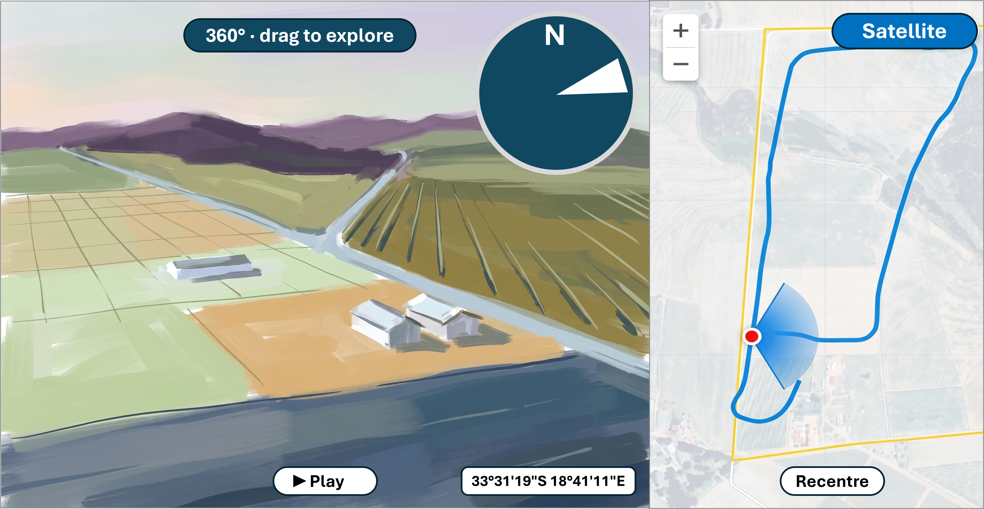
The video and the map share a single timeline: the compass, the coordinates, the boundary line, and the camera's live position all update together, frame by frame.
Explore Interactive Flight Demos
Unique Interactive Features
1. Full Camera Control
360° Drag-to-Explore
Control the camera angle. Drag anywhere on the video frame at any moment to look up, down, or around in a full sphere.
Interactive Compass Steering
A live video compass displays true real-world heading. Drag the compass dial itself to turn your view instantly.
Bird's-Eye Overhead Swivel
Smoothly tilt the view straight down to inspect ground details, crops, or building layouts directly beneath the drone, then return to horizontal viewing with a single click.
Zoom the Field of View
Zoom in for detail or out for context, without ever leaving the 360° sphere. The compass cone and map wedge widen and narrow to match, so the map always reflects exactly what is on screen.
2. Live Spatial & GPS Accuracy
Synchronized Field-of-View Cone
A directional cone on the live map rotates and expands in real time. It reflects the exact field of view and zoom level visible in the video, giving instant context to what you are looking at.
Verified Cadastral Boundaries
Official property lines and neighboring parcel outlines are drawn directly over the map layer, removing guesswork about where land lines begin and end.
Live Coordinates & Telemetry
Live GPS coordinates update continuously on screen, tied directly to the camera's exact position, for pinpoint spatial accuracy.
Live Drone Position Marker
A marker tracks the camera's exact position on the map as the video plays, always showing precisely where each shot was captured.
3. Seamless Navigation & Viewing
Click-on-Path Navigation
The entire flight route is traced on the map. Click anywhere along the drawn path line to jump the video directly to that exact geographic spot instantly—no timeline scrubbing needed.
Dual Fullscreen Modes
Choose between expanding just the 360° video for total immersion, or launching the combined split-screen view to keep the video and live interactive map edge-to-edge.
Satellite & Street Map Toggles
Switch between clear topographic street maps and high-resolution satellite imagery to analyze terrain, crop cover, or structures from both perspectives.
The Whole Flight, Drawn Out
The full flight path is drawn out from the very start, so every angle you can explore is visible at a glance—not just where you happen to be right now.
Auto-Follow, with Override
The map automatically tracks the camera's position as the video plays. Pan off to explore on your own, and one click brings you right back to the live view.